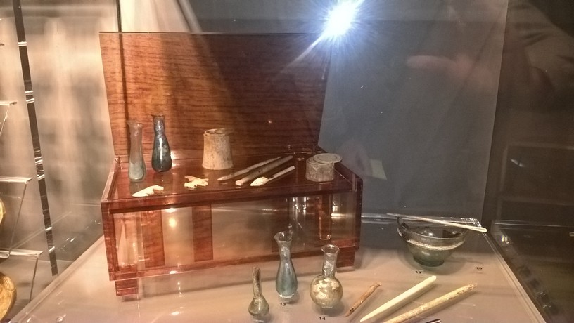
The oldest known map showing the ancient settlement of Burnum dates back to the 2nd century
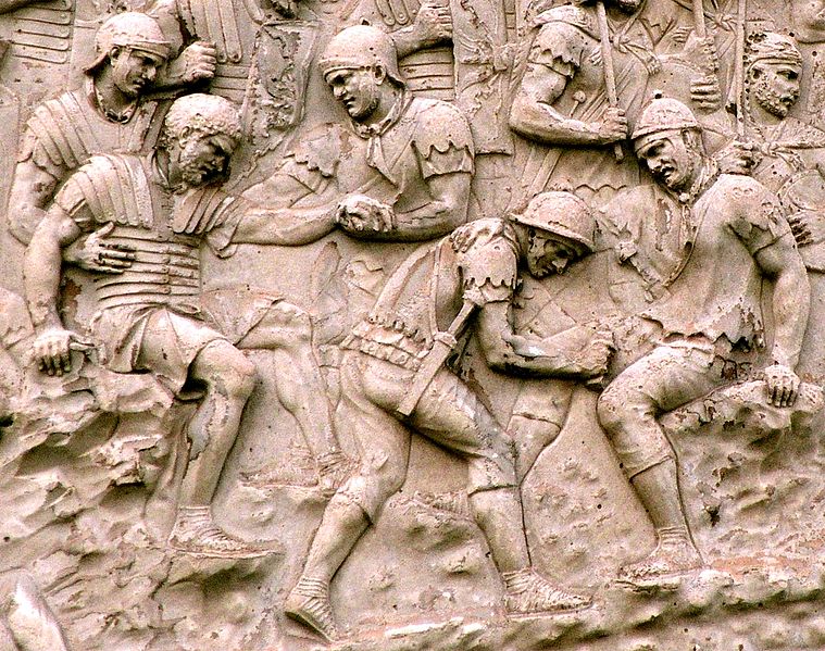
The oldest known map showing the ancient settlement of Burnum, called the Quinta Europe tabula (Fifth Map of Europe) dates back to the 2nd century, and is found in Volume 5 of the series Geography by Alexandrian mathematician, astronomer and geographer, Claudius Ptolemy. The original of this work has not been preserved, and knowledge of it derives from a medieval transcript. This is the earliest map to show the area of the Krka River (Titius Flumen). West of the Krka, Ptolemy positioned Burnum, the most significant military camp in the Roman province of Dalmatia, which existed through nearly the entire 1st century before being transformed into a city (municipium) in the early 2nd century.
The next mention of Burnum in the old maps dates back to the mid-4th century in the Tabula Peutingeriana, the Peutinger Table, as an illustrated map that outlines important travel information: roads, settlements, inns, etc. It is believed that this map was created by the Roman cartographer Castorius in about 340 AD. It shows nearly all the main Roman roads in the Illyrian and Pannonian regions, with travel stations and the distances between them. The map that is today conserved at the National Library in Vienna is a copy from 1498 made by Viennese humanist Konrad Celtes. This map at one point came into possession of the German scientist Konrad Peutinger, and was thus named after him. It consists of 11 jointed sheets with total dimensions of 682 x 34 cm.
The Peutinger Table shows two main ancient road routes in the Krka area: in the interior this is the Via Senia usque ad Salonam, also known as the Via Gabiniana, and the second in the coastal area was the Via as Iadera usquae ad Salonam that passed through Scardona.
The museum collection of Krka National Park houses an entire copy of the Peutinger Table from 1887, prepared for print by German geographer and archaeologist Konrad Miller (1844 – 1933).
After a millennium, Burnum again appears on the late medieval map Tuto el Contado di Zara e Sebenico by Venetian cartographer, Mateo Pagano. The map was printed in the wood block technique, and appears to date to about 1530. It depicts the coastal area and Dalmatian inland, including the area of the Krka River. The map marks the archaeological ruins of the ancient Burnum (called Bergane on the map), which clearly shows the ruins of the arch of the town basilica (still preserved today). Due to the remaining ruins of the former military camp that was later a municipality, this location was likely impressive and therefore drawn into the map. Pagano’s map later served as the foundation for the work of Šibenik cartographer Božo Bonifačić (Natale Bonifacija) (1537–1592), one of Croatia’s most prominent copper plate etchers, illustrators and cartographers. Judging by a number of similarities and nearly identical graphical images on Bonifačić’s map of the Šibenik-Zadar area, Pagano’s map was the foundation he used. Bonifačić’s map was beautifully designed and is graphically more attractive than the Pagano map. It was given to Martin Kolunić Roti of Šibenik, who is credited with having the map printed in 1570 the Theatrum orbis terrarun, the most important world atlas of its time and published by the Dutch publisher Abraham Ortelius. The atlas was printed in 41 editions.